Thursday Jan. 30, 2025
Morning walk: 2.02 miles. Weather: 42°, sunny. My first 2-mile walk in a while. I felt it a little by the time I was done, but not horrible. I am beginning to wonder if constantly walking on pavement is a good thing, but so far I really haven’t felt any detrimental effects.
Over the past two days, AML and I have taken a few short road trips. I underestimated the distances here. When you look on a map, it doesn’t seem too far to get to some of these places, but then you start the drive, and it’s surprising how far you’ve actually traveled. Tuesday we took a trip out to Chiricahua National Monument, known as the stronghold of the Chiricahua Apache Chief Cochise. The medicine man Geronimo also held out in this region. The route took us through Tombstone for the first time, but we did not stop, although we did note the location of the OK Corral. Once we left Tombstone, the region turned into endless grassland not unlike parts of western Nebraska. The road was flat and narrow, without a shoulder to speak of. It is not a place where you want to break down or run out of gas. You also start to get the feeling you have the road all to yourself, as hardly anyone else is on the road.
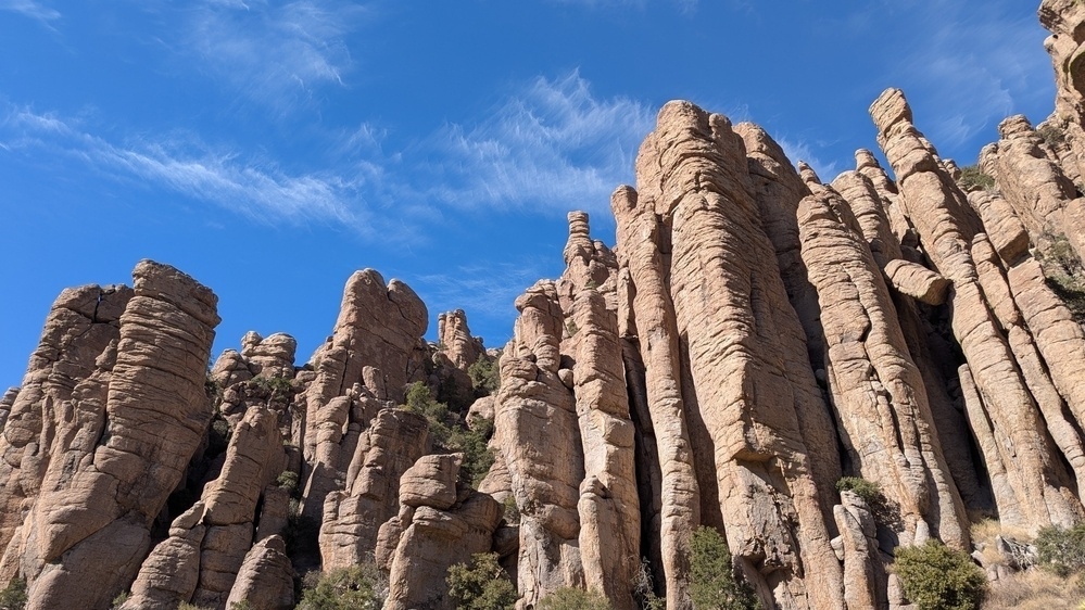
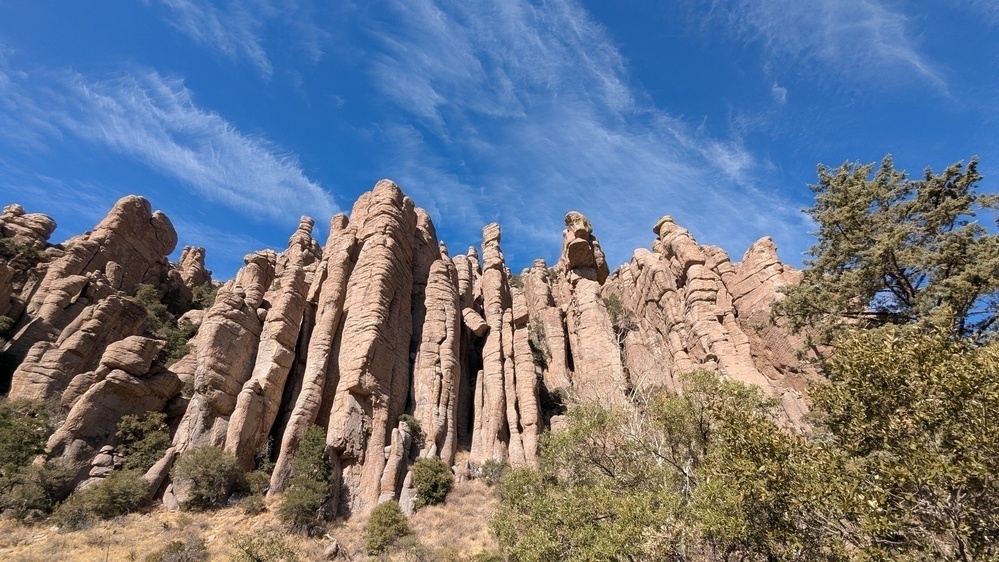
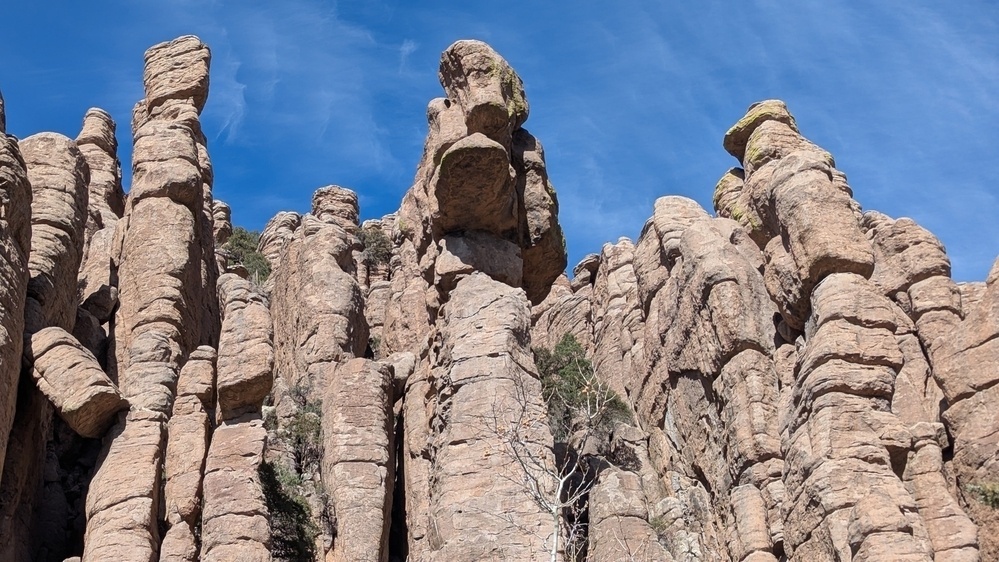
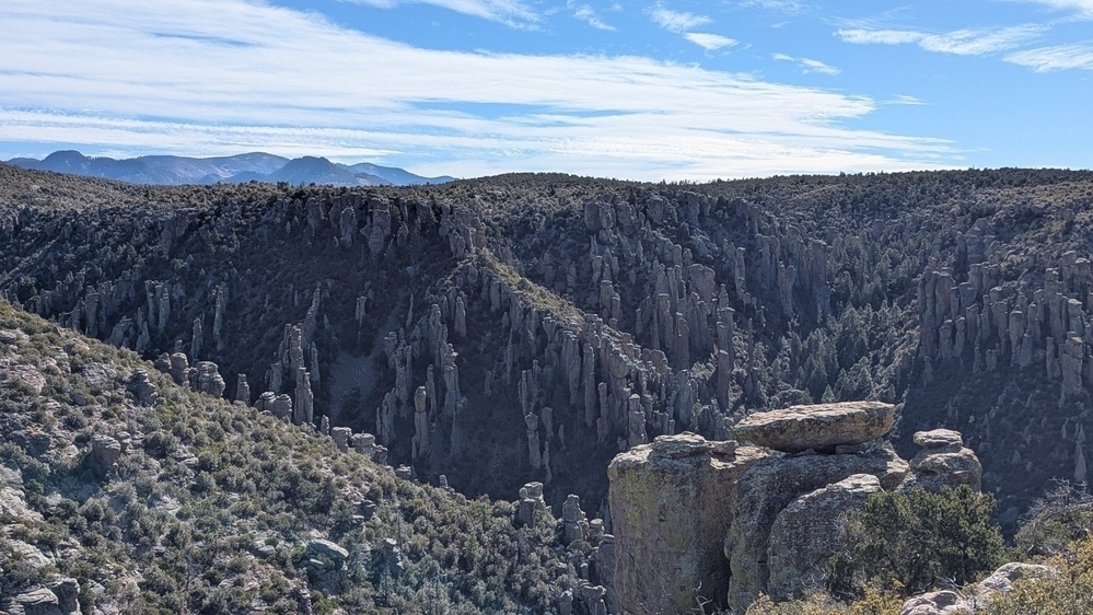
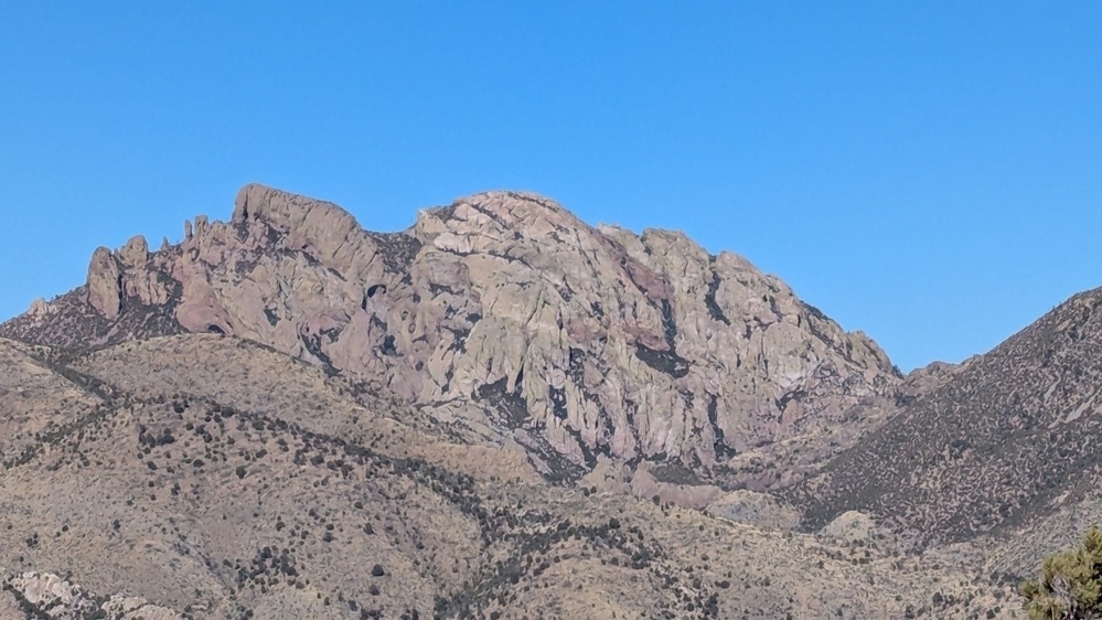
The Chiricahua range is famous for its striking rock formations, or hoodoos. They are columns and spires of rock with other rocks and boulders perching precariously on one another. Looking at them, you cannot fathom how it just doesn’t all fall to pieces. We stopped at the Visitor Center, and then headed up the Bonita Canyon Road, which takes you up about 1500' for some astounding views. Check out the collection below for pictures. One of the formations is called Granite Head, and it looks like a man lying on his back with his face to the sky. It is said to be the image of Cochise.
When we came back down the road, we though we would drive up to Willcox, which sits off I-10, and get some lunch. But again, we misjudged the distance and time, and so rather than eat a very late lunch, we just continued on home, stopping at The Thing! for a quick look at this tourist site (don’t bother).
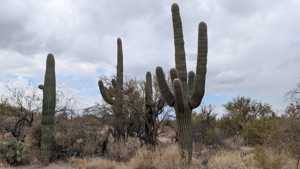
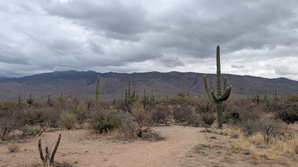
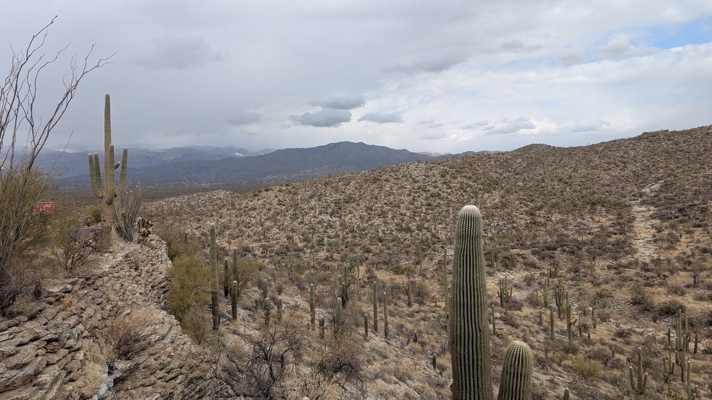
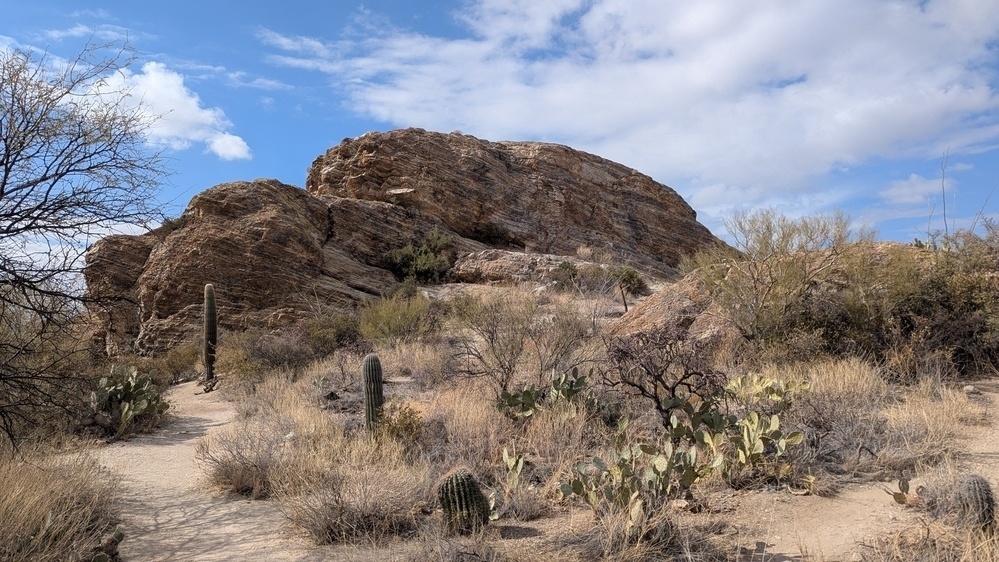
Yesterday we thought that, by getting an earlier start, we’d get two activities done. We set out to visit Saguaro National Park, and also to drive the Catalina Highway to Mt. Lemmon. We packed a lunch to enjoy somewhere on the drive. But we spent so much time in Saguaro NP that we didn’t feel we had the time to fully enjoy the Catalina Highway, so we ate a casual lunch in the park.
We of course stopped at the Visitor Center and checked out their movie on the park’s biodiversity (has Trump outlawed biodiversity yet?). Then we drove the Cactus Loop designed to give visitors a close-up experience of the park without leaving their cars. You get so captivated by the views that you continually stop to take pictures, which of course eats up time. But for an Easterner like me, this park represents the stereotypical image of the mythological American West. The saguaro cactus is iconic as well as majestic. The paved loop road also appears to be a popular place among bicyclists from Tucson, who ride the paved loop road with vigor.
I was going to hike one of their short one-mile trails, but the threatening clouds to the west convinced me otherwise. As we headed home, we ended up driving in bright sunshine, rain, and snow! We took a scenic route - AZ83 - down to Sonoita through the St. Rita Range, a small collection of hills that carve out a very scenic drive. The Sonoita region is an AZ viticultural area, and I stopped at the one general store to see about picking up a local wine. The prices were stunning - $35 for the bottle I chose - particularly because I live in a wine-growing region myself. Bottles of local wine back home go for $12-17 at most. I suspect the difference has to be the items they need to import to AZ to grow grapes. In the whole drive I never saw a single grape field, so that remains a mystery.
It was a good two days of sight-seeing, and today was spent paying monthly bills and getting re-supplied. The weather is supposed to take a turn for the warmer, and I hope it does, because I am itching to get out on some of those forest roads and maybe do a campout or two. 70° in February sounds good to me.