Out Where I Didn't Belong
About a week or so ago I took my Trail rider out for a spin. I wanted to find a back road to ride, and I headed off in the direction of Tombstone (yes, that Tombstone). My GPS indicated there were a few back roads located in the region on Arizona State Trust Land (i.e. public land), and I did manage to find one. I pulled through the gate and headed out for the adventure, glad to have found an off-pavement road to explore.
About three-quarters of a mile in, however, I ran into something I didn’t bargain for. Now, if I had read the contour lines on the topo map on my GPS more carefully, perhaps I would have noticed the steep decline I was now perch on the edge of. The way forward consisted of riding down a very steep incline on a road that was washed out, rutted, and filled with chunky rocks, crossed a dry wash that was filled with sand, and then had to climb up an equally stretch of bad road to get to the top of the ridge on the other side.
I do not have enough skill as an off-pavement rider to tackle this kind of technical terrain. I spent probably 10 minutes trying to decide whether I should move forward or turn around and go back. I studied the road carefully, trying to decide what the best line to take would be. Every line had its possibility for dropping the bike. Ride too far to the left or right and you risk sliding sideways. Ride in the center and you risk the front tire getting caught in a rut and the rear tire spinning out on you. Fail to build up enough momentum and, even if you make it down in one piece, you may not have enough speed to get through the sand. Choose the wrong gear, and you may not have enough torque to get you up the incline on the other side.
In those 10 minutes, I had to try and synthesize all the information I’d been watching from all the off-pavement dual-sport YouTube videos I have watched in the past. I bought the Trail Rider primarily to ride on back country roads and smooth dirt and gravel roads. I really had no intention of ever taking it on a technical surface such as this.
I made the decision to go forward, not out of any bravado, but because I thought if I didn’t try to tackle this, then I wouldn’t learn anything. I knew that, technically speaking, this was beyond my limits, and I am not someone who likes to test his limits. I felt I had found the best line possible downhill, and then I figured when I got to the bottom I would just gun it in first gear and hope for the best. The line I picked had me going along the right edge of the road to the bottom, across the middle, and up the left side of the other side.
The greatest advantage I had was being on the Trail Rider. I deliberately picked this bike because of its light weight, and the fact that I can flatfoot the bike when stopped. I literally inched down the side of the road, cautiously using the hand and foot brakes to make sure I was going as slow as was possible. My left foot was out on the side of the road, securing my balance and preventing a fall to the left should the bike slide sideways. It must have taken me maybe five minutes or so to travel 25' forward downhill. When I was close to the bottom, I released the brakes and gave it the gas in first gear, which propelled me through the sand with the rear sliding slightly to the right. I headed for the left side of the road with the throttle still wide open, and as the bike gained traction I used my feet on both sides to balance myself and stay upright. When I got to the top of the ridge, I was surprised and stunned that I had made it without dropping the bike.
Having successfully gained the other side, I realized there was no turning back at that point. The surface of the road remained rocky and technical, and so I just crawled along slowly at about 5MPH. I had to negotiate two other similar dry wash crossings, building on the little experience I was gaining with each one.
I finally got to the end of the road, only to discover at the crossroads that the gate leading into the BLM land was secured. The gate would not open. The road beyond the gate was supposed to lead to a state highway on the other side, but now there was no way to get to it. I had two options: return the way I had just come, or take the road leading east into the unknown. The GPS indicated the road would eventually fork and lead back to the highway I rode up on. So I went east.
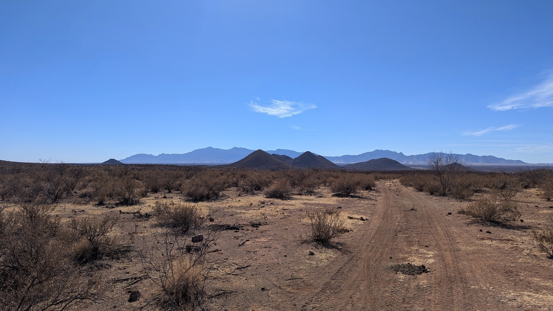
As it turned out, the ride east was not as problematic as the road I had been on. It was still rutted and chunky, but level. I knew going slowly I could handle this. I found a place to take a break, and as I pulled off my helmet and unzipped my jacket, I began to take in my surroundings. There was nothing but desert around me for a few miles. It was hot, but I had plenty of water, and I knew I was in no immediate danger. But thoughts of what would happen to me were I injured, or the bike had broken down or gotten a flat began to creep in. I had neither the strength, ability, nor tools to fix a flat in the open. Any mechanical issues, and I’d be sunk - not sure AAA would have come out to where I was. The map told me I was not very far from a main highway, but nonetheless the thought of being stranded out there was slightly nerve-wracking. If I had had to walk back out to the highway, it would not have been an easy walk in my riding boots. I took a few pictures as well as a 360° video to document the location, got back on the bike, and safely found my way back to the highway.
I can’t deny there was a certain thrill to having gotten through the situation. On the other hand, I was somewhere I didn’t belong, and when that happens, bad things can occur. I was not out there to test my limits or any such thing. I wanted a simple ride, but not knowing the region as well as I should, I got caught out. Maps can only tell you so much. I’ll continue to ride, but I hope the roads I find will be a little less stressful than that.